Palisades and Eaton Fires
Post-Fire Burn Severity and Four-Month Vegetation Recovery Assessment Using NBR and NDVI
This study analyzes the effects of wildfire and post-fire vegetation recovery in Southern California through a remote sensing-based case study of the Eaton and Palisades Fires that ignited on January 7th, 2025.
The study includes two assessments:
Post-Fire Burn Severity
Four-Month Vegetation Recovery
Post-Fire Burn Severity was calculated using Landsat 8/9 satellite imagery from January 6th (Pre-Fire) and January 14th (Post-Fire) using Normalized Burn Ratio (NBR) and its differenced form (dNBR). Burn severity classification was derived from dNBR.
Four-Month Vegetation Recovery was calculated using Landsat 8/9 satellite imagery from January 14th to May 30th using Normalized Difference Vegetation Index (NDVI) and its differenced form (dNDVI). Vegetation Recovery classification was derived from dNDVI.
Key Findings:
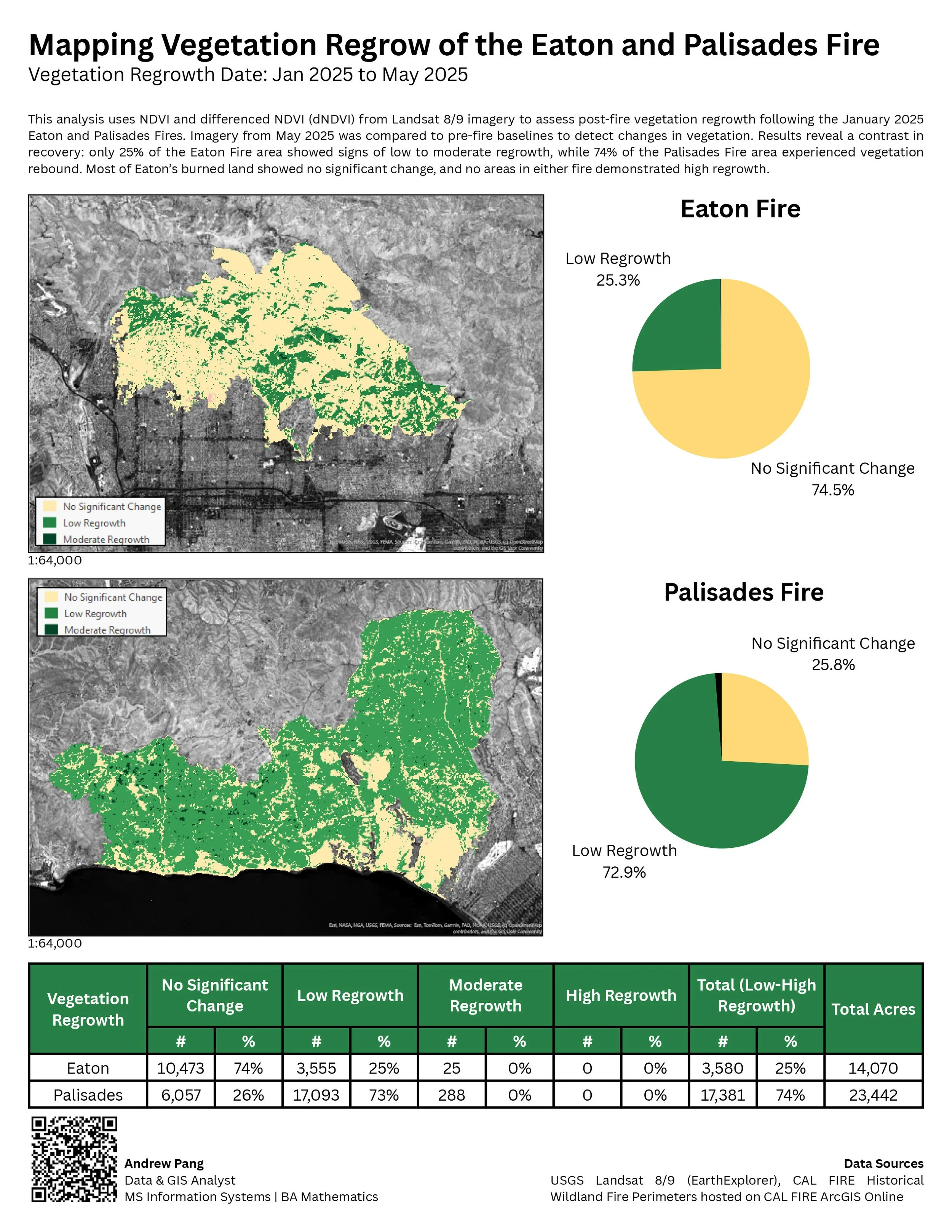
The total area burned for Eaton Fire was 14,070 acres and Palisades Fire was 23,442.
Results showed that 76% of the Eaton Fire area and 86% of the Palisades Fire area experienced low to high burn severity.
However, vegetation regrowth differed drastically: only 25% of burned land from Eaton fire showed signs of regrowth, compared to 74% in Palisades.
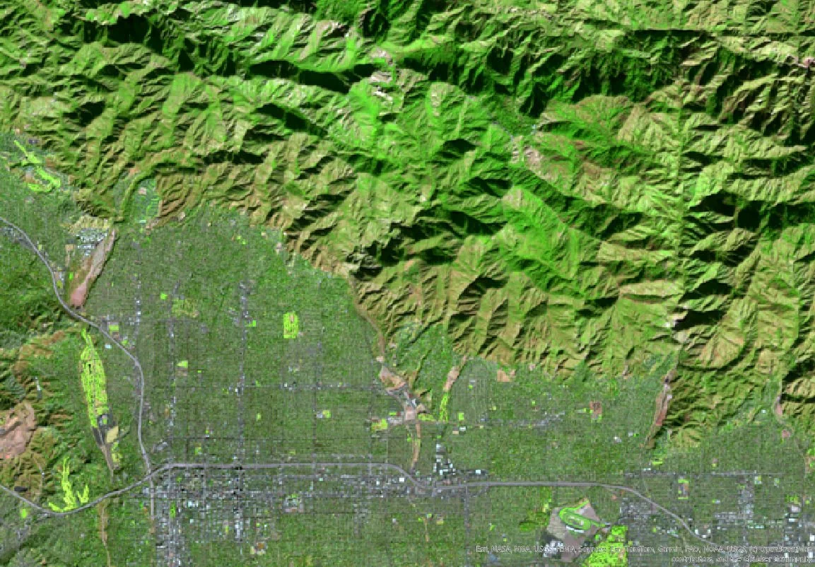
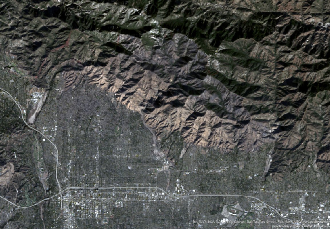
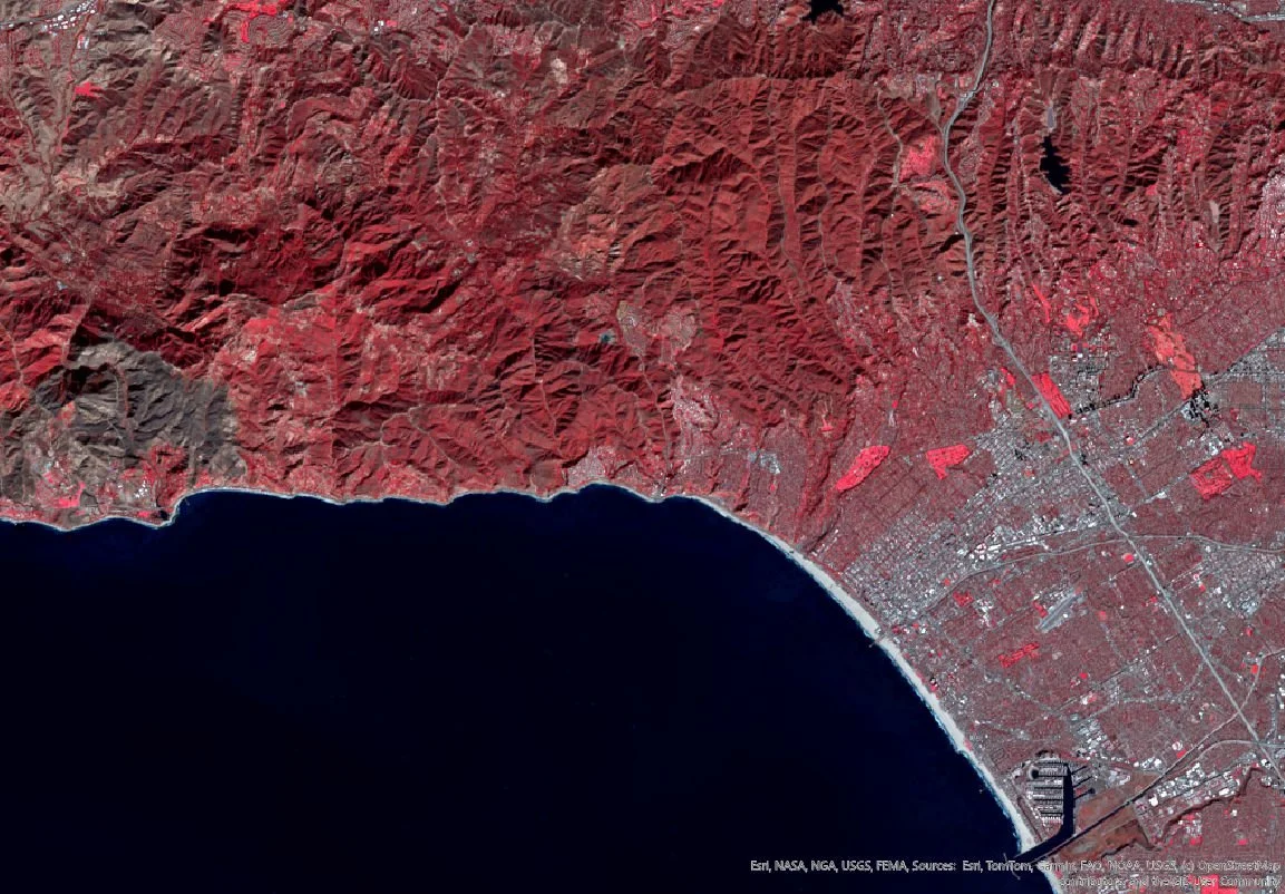
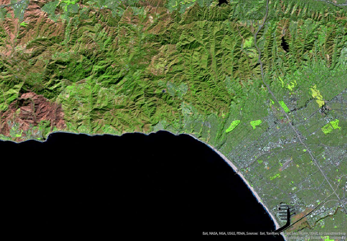
NBR (Normalized Burn Ratio) view derived from Landsat 8/9 data

Eaton Fire
Jan 6, 2025 (Pre-Fire)

Palisades Fire
Jan 6, 2025 (Pre-Fire)

Eaton Fire
Jan 14, 2025 (Post-Fire)

Palisades Fire
Jan 14, 2025 (Post-Fire)
Burn Severity derived from dNBR
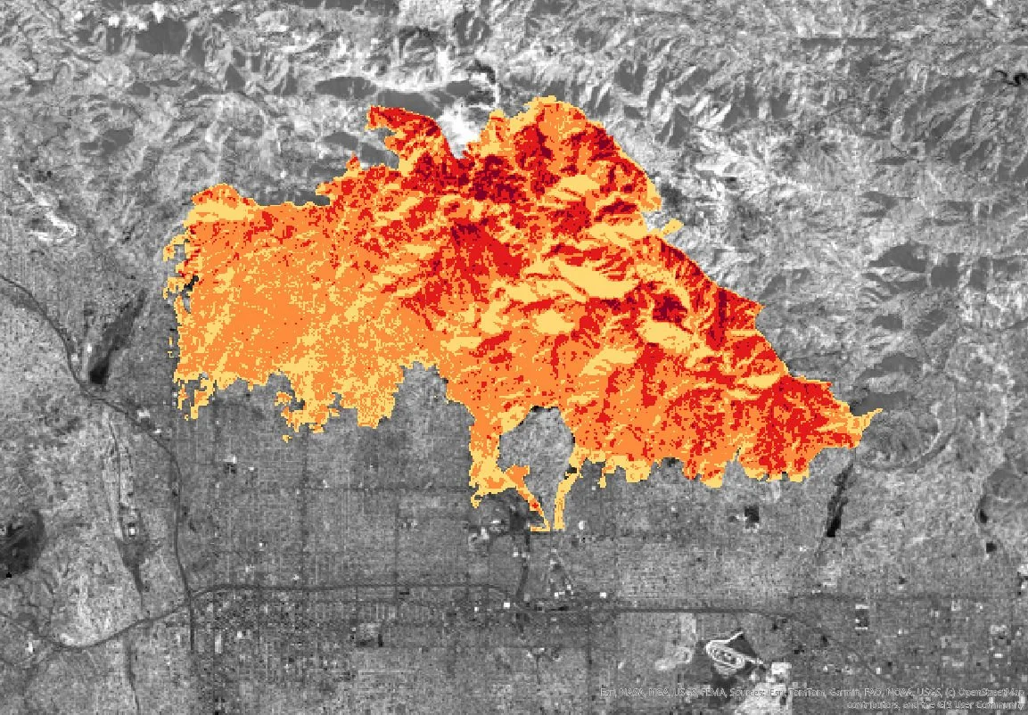
Eaton Fire

Palisades Fire
Four-Month Vegetation Recovery derived from dNDVI
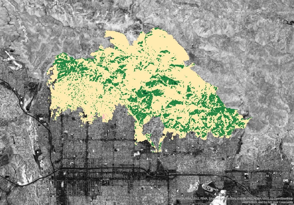
Eaton Fire

Palisades Fire


Gallery